Lead Mines Clough and Other Stuff
It's been a while since I've visited the upper reaches of Lead Mines Clough, so I decided to head up there last Sunday, only to get a sharp reminder of just how unfit I've become.
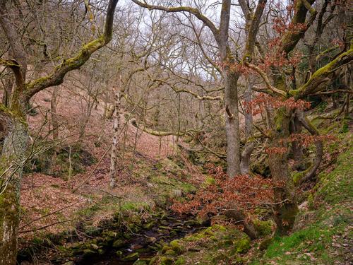
Lead Mines Clough is a steep sided gorge formed by Limestone Brook as it leaves Anglezarke Moor and makes its merry way down the hill to eventually merge with The River Yarrow right before the point where the Victorians came along and captured the combined sum of their outputs (along with a bunch of other moorland streams) in the Yarrow reservoir.
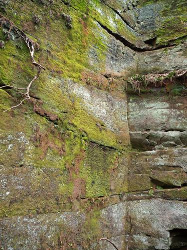
It was a gloomy Sunday morning when I parked the car there and set off with my usual GFX kit (GFX100S, 23-35, 45-100, tripod and filters) along the path leading to the gorge. The gorge itself is steep sided and composed of rocks covered in mud. Lots of mud. There's an easy path that runs along the top of the gorge, but that route completely misses several excellent waterfalls, so I chose the more interesting route that runs a little way up the hillside above the river, a path that required the use of the tripod more than once to avoid sliding off it and into the brook (something I once, painfully, did about 15 years ago, falling about 10 foot onto the rocky riverbed and flinging my GH4 across the stream in the process).
On this occasion I carefully made my way along this path to reach one of the bigger and more secluded waterfalls, before finally deciding I couldn't manage any more of it and instead scrambled up to the top path which I followed for the remainder of the walk to the head of the gorge where another nice waterfall can be found. I think there's another even more impressive fall somewhere between these two, but I'm not sure I'm up to getting to it right now, so I didn't even bother trying.
The walk was tough and I was exhausted by the time I reached the turn back point at the head of the gorge. My Garmin reckoned I'd walked about 2.5 miles, so I took the easy option of following the good path that runs along the top of the other side of the gorge to wearily head back to the car.
The Garmin claimed I'd walked about 4 miles by the end of it and I certainly felt like I had, but manually checking the OS maps later I measured about two miles in total and 250ft of ascent. The main reason for this disparity was the tree cover that lines the side of the gorge, causing the GPS to jitter excessively when it can't get a solid signal. I wonder if the new Fenix's are any better in this regard?
Anyway, pictures...
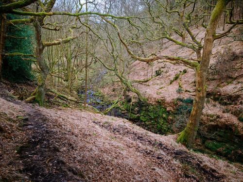
The Start of The Gorge
This is looking upstream as the sides of the gorge begin to rise. There's a path on the right there, somewhere.
Looking Back
This is the view looking downstream from the path having followed it for a while. I was enjoying the organised chaos of the woods and the many charismatic trees that line the side of the gorge. You can see how the side of the gorge falls off sharply at the river, with anything up to a 20 foot straight drop into the shallow waters, so it pays to tread cautiously along here.
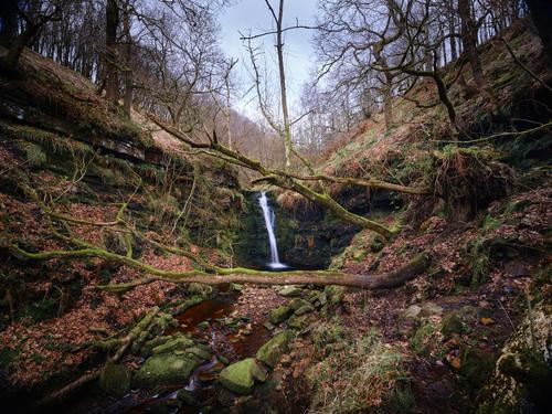
The Big Fall
This waterfall lies about a third of the way along the gorge and is very tricky to safely reach due to various fallen trees and the decaying muddy path that leads to it. I did consider getting closer, but I was pretty exhausted just getting to this point. One for another time when I've turned my fitness around.
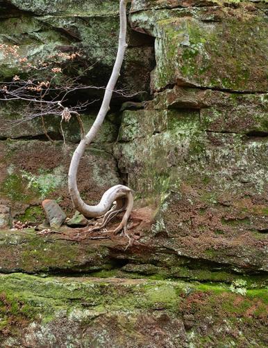
Wizards
Having retraced my steps from the waterfall, I then scrambled up the side of the gorge to reach the far more civilised top path. Although you can no longer see much of the river from here, there are plenty of other interesting things to point the camera at, such as these two trees duking it out for hillside supremacy. This is what it looks like in reality.
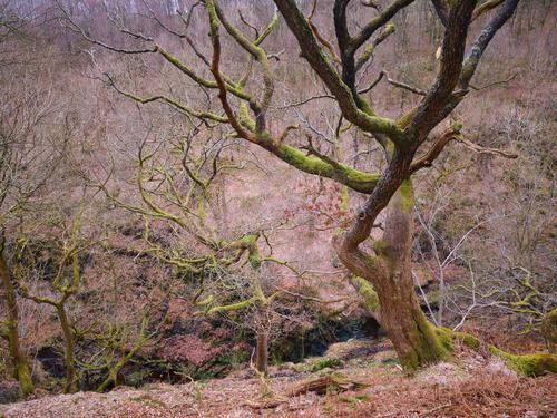
But in my minds eye, there's a much more dramatic battle going on, that might look a little like this (best I could do in C1P without resorting to an actual drawing program such as Photoshop or Affinity)...

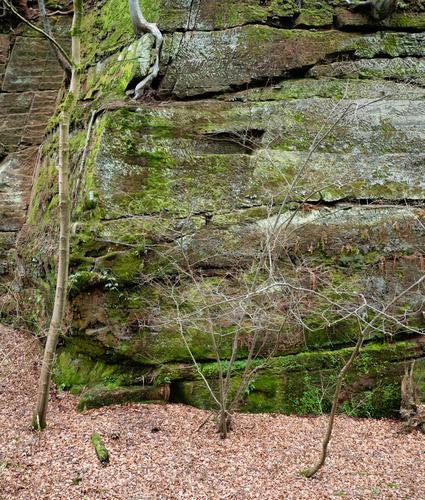
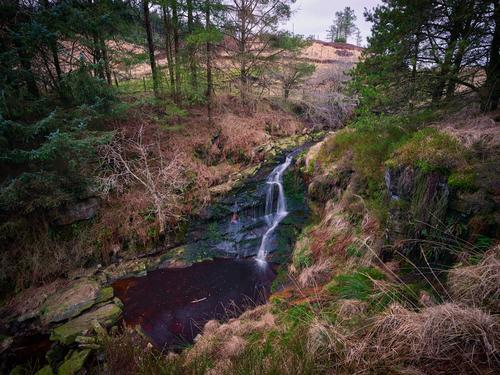
The End of The Gorge
Finally, after what seemed like miles of exhausted walking, but in reality was about a mile of exhausted walking I reached the top of the gorge. Beyond this nice little waterfall lies the open moor, which Limestone Brook cuts a path across all the way from the summit of Black Hill, even crossing the path I walked to Great Hill a couple of weeks ago. Round loaf is only a mile or so off to the top right of this picture, but I didn't have the energy to tack that onto the walk, so instead I settled for sitting here a while enjoying the solitude of this secluded spot, well, until some guy startled me as he crept up behind me to take a better look at the waterfall. I have previously photographed this from the level of the river, but I think it looks better from this angle.
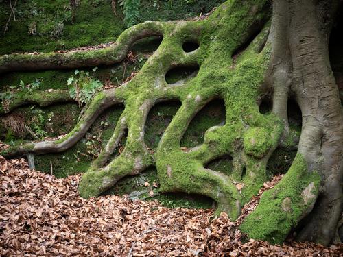
Tree
Just a nice looking tree I spotted on my way back down to the start of the walk. It's done well holding onto those leaves through what's been quite a blustery winter. New ones will be on their way very soon.

The Sunday walk left me physically quite exhausted for a few days, which it really shouldn't have done, but after a few short walks during the week pushed myself to do a legit (no trees to confuse the Garmin) four mile walk on Thursday evening, albeit with no real enthusiasm, but it was quite a nice night and I felt like I really needed the exercise.
To make it a bit more palatable, I pared the equipment down to just the little X-T50 and 27mm f/2 lens. Quite a restrictive combo and a 40mm equivalent lens that's not particularly well rated, but often delivers the goods.
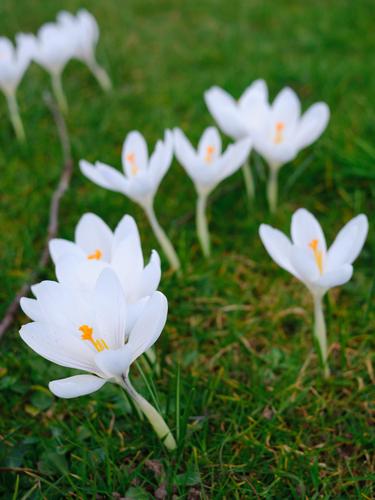
Flowers
Some flowers I spotted beside the main road.
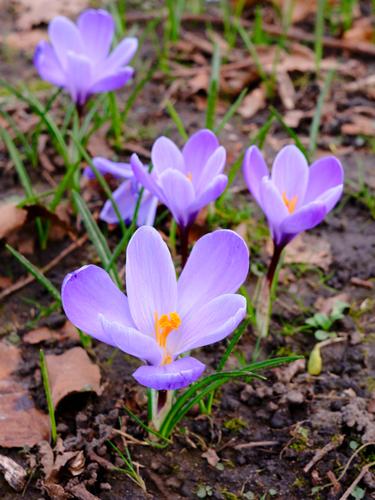
More Flowers
A little further along the A6 I found this nice cluster of flowers also springing up. I guess these have all been planted by the council at some point to make the place look a bit nicer. Personally, nice though they are, I'd prefer it if they spent the money on fixing the roads so the don't resemble the surface of the moon, but that's just me.
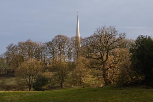
The Mormon Temple
My route took me down Moss Lane, a very old local road that leads down from the A6 to the Leeds / Liverpool canal. Along here would be quite good views of the Mormon temple if it wasn't for the scrubby trees that line that side of the lane. At the time I took this, the sun was quite low and soft, golden light was spilling across the distant fields, which I could see through gaps in the trees, but couldn't get a clear shot of. Eventually I found a gap that gave me this view, but I'd had to give up much better ones that spaced all of these elements out more nicely, but had various foreground obstructions. This was also one of those times where I was regretting not bringing a longer lens, so this is a relatively tiny crop from the full image.
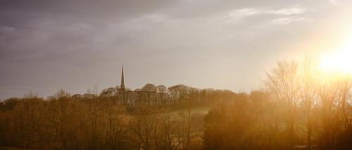
The Mormon Temple 2
Eventually, Moss Lane crosses the M6 motorway. I had hoped that the motorway bridge might give me a clearer shot of the temple as the light was still nice, but the trees planted to hide the motorway also did their best to conceal the temple too. Normally I would have bracketed a shot like this, but in this instance I just took a single shot with a little bit of negative exposure compensation, allowing the sky around the sun to blow out a bit more than I would have liked. Again, a longer lens would have been an advantage, leading to a more conventional crop (this is 2.35:1, i.e. cinemascope) without having to worry about excess sky or the motorway at the bottom of the frame.
A Lone Tree
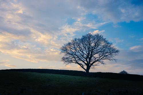
As I turned the corner at the bottom the lane before it finally reaches the canal, I noticed this lone tree silhouetted against a nice and dramatic sky. I did spend some time trying to inject more sunset tones into the sky, but most of what I tried looked very fake and monochromatic, so this is more faithful, albeit tweaked a little. It's a pity there's a bit of tree peering over the wall from the adjacent field and there are few bits from the top of the holly bush that lines the side of the road hiding in the shadows at the bottom of the frame.