• Members 1393 posts
    Jan. 24, 2026, 10:55 a.m.

    Good morning to everyone wherever you are in the world...seems I didn't amend the dropdown AGAIN so first thread was lost in misplaced posts. Hence I started another.

    • This long-running thread, originally for Micro 4/3 on DPReview, now welcomes all brands of camera.
    • Keep it polite. Leave your guns and knives at the door.
    • A new week begins on Saturday morning (UK time).
    • It can get a bit tangled in here; please edit your post to make it clear to whom you are replying.
    • Don’t just post and run, please comment on other peoples’ work.
    • Posting in this thread implies you’re happy to receive feedback.

  • Members 1393 posts
    Jan. 24, 2026, 10:55 a.m.

    Odd Couple.jpg

    Odd Couple.jpg

    JPG, 3.7 MB, uploaded by Wormsmeat on Jan. 24, 2026.

  • Members 793 posts
    Jan. 24, 2026, 11:19 a.m.

    Evening walk

    Took another evening walk in the nearby park with OM-3. It was quite cold and my fingers got frostbitten but got some ok photos.

    P1200003.JPG

    P1200010.JPG

    P1200026.JPG

    P1200035.JPG

    P1200050.JPG

    P1200076.JPG

    P1200078.JPG

    P1200056.JPG

    P1200078.JPG

    JPG, 1.9 MB, uploaded by Vahur on Jan. 24, 2026.

    P1200076.JPG

    JPG, 2.1 MB, uploaded by Vahur on Jan. 24, 2026.

    P1200010.JPG

    JPG, 2.0 MB, uploaded by Vahur on Jan. 24, 2026.

    P1200035.JPG

    JPG, 2.0 MB, uploaded by Vahur on Jan. 24, 2026.

    P1200026.JPG

    JPG, 1.9 MB, uploaded by Vahur on Jan. 24, 2026.

    P1200056.JPG

    JPG, 1.9 MB, uploaded by Vahur on Jan. 24, 2026.

    P1200050.JPG

    JPG, 1.9 MB, uploaded by Vahur on Jan. 24, 2026.

    P1200003.JPG

    JPG, 2.0 MB, uploaded by Vahur on Jan. 24, 2026.

  • Members 793 posts
    Jan. 24, 2026, 11:25 a.m.

    Interesting couple, is this art project? I see "sit here" label, for selfies, I presume. Maybe in this case bit less depth of field would have helped to isolate this couple bit more?

  • Members 1393 posts
    Jan. 24, 2026, 11:26 a.m.

    Don't know why you put these two out last! Excellent.

  • Jan. 24, 2026, 11:35 a.m.

    I like these two a lot.

    David

  • Jan. 24, 2026, 11:36 a.m.

    I am not sure what this represents. Is it possible to denoise it, or post a raw version somewhere, so I could do so?

    David

  • Members 1393 posts
    Jan. 24, 2026, 11:52 a.m.

    I have a full colour, denoised version but I liked the mystery of this desaturated one.

  • Members 2127 posts
    Jan. 24, 2026, 12:55 p.m.

    Stormy weather

    P9190095xDP.jpg

    P9190095xDP.jpg

    JPG, 317.1 KB, uploaded by ChrisOly on Jan. 24, 2026.

  • Members 2127 posts
    Jan. 24, 2026, 12:57 p.m.

    Like semi-dark mystery of this capture.

  • Members 2127 posts
    Jan. 24, 2026, 12:59 p.m.

    Stellar.

  • Members 1393 posts
    Jan. 24, 2026, 1:17 p.m.

    Beautiful how the clouds echo the waves and maintain the same colour.

  • Members 476 posts
    Jan. 24, 2026, 1:31 p.m.

    The Wintry Moors

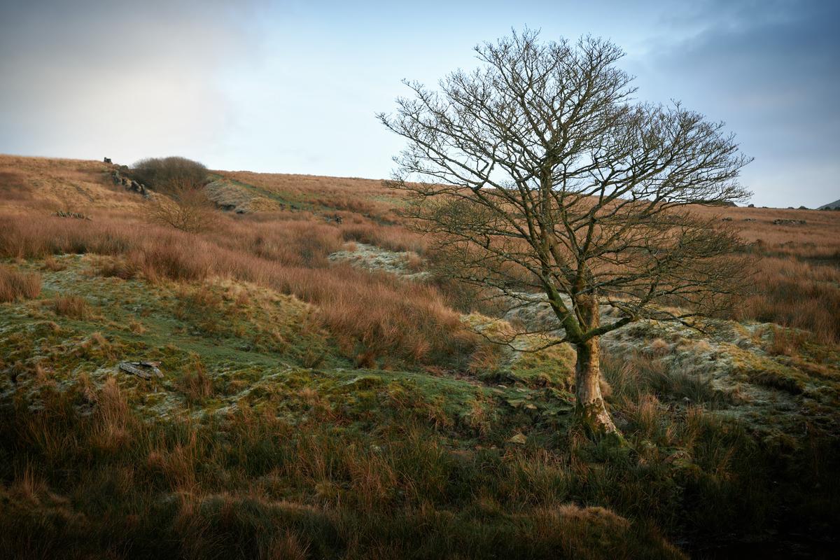
    This set is from a couple of weeks ago when I decided to revisit the easterly reaches of Anglezarke moor. I had a much grander tour of the area planned in my head, but due to delays in setting out I had to settle for a more modest walk, besides, I think the longer walk I had envisaged is still a bit beyond me at this point in time. So, in the end, I settled for a walk from Hordern Stoops to the highest point of Redmond's Edge, at which point I struck out across the moors to descend via the misleadingly named Standing Stones Hill (well, it's a hill, I can't argue with that, but there's no record of anyone ever finding standing stones up there).

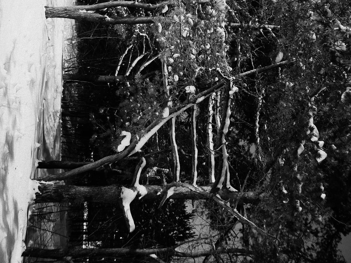
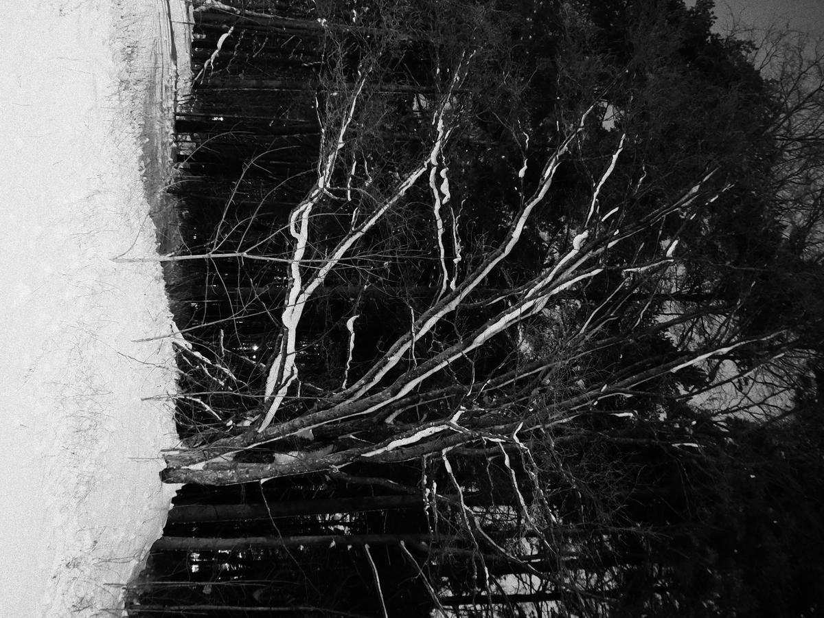
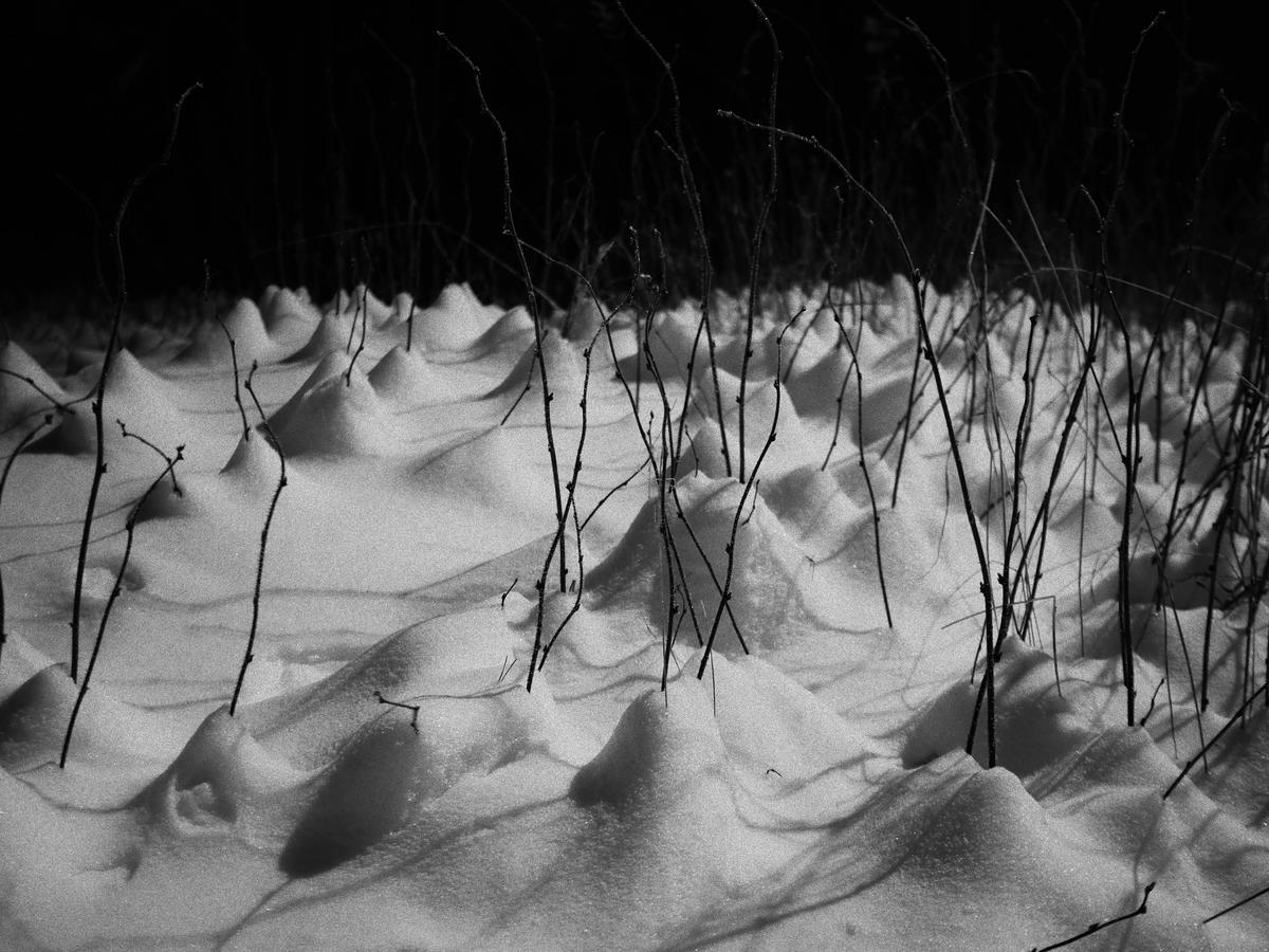
    There had been a big freeze during the week prior to this walk, so the ground was generally solid under foot, although the stone path over Spitlers Edge and Redmond's Edge was something of a death trap, still, it probably beats sinking into a bog when crossing the moor in warmer conditions. Probably. The light was bright, but soft, with a light mist in the valleys. I find this to be ideal conditions for moorland photography.

    The camera of choice for this trip was the Z8 with the 24-70 f/2.8S and 70-180 f/2.8, which performed excellently in my gloved hands. I think most of these were taken with a CPL to darken the sky and reduce reflections (at least the shots with the 24-70 were, I still don't have an adapter for the 70-180).

    Ramblers

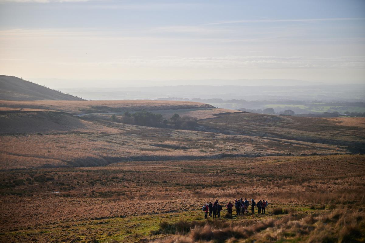
    As I made my way up Spitlers Edge, a steady stream of ramblers were passing in the opposite direction, there must have been a lot of them as it took ages to pass the entire group. Here are about half of them assembled below me on the path leading to the Hempshaw's ruins, waiting for their associates who were slowly trickling over Spitlers Edge. In the background are the lower flanks of Noon Hill, with Rivington behind that.
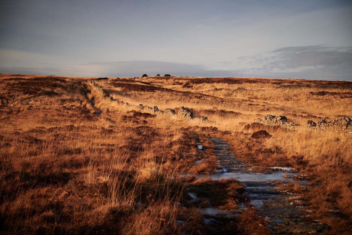
    DSC_1085.jpg

    The Path Of Doom

    As mentioned earlier, the path over both edges was very icy and probably a main reason for the ramblers group being so widely distributed along the route. For the most part I stuck to the peaty soil at the side of the stones to avoid breaking my neck or more importantly, my camera! This is looking in the direction I'd just come from, with Winter Hill looming in the background, as is its way.
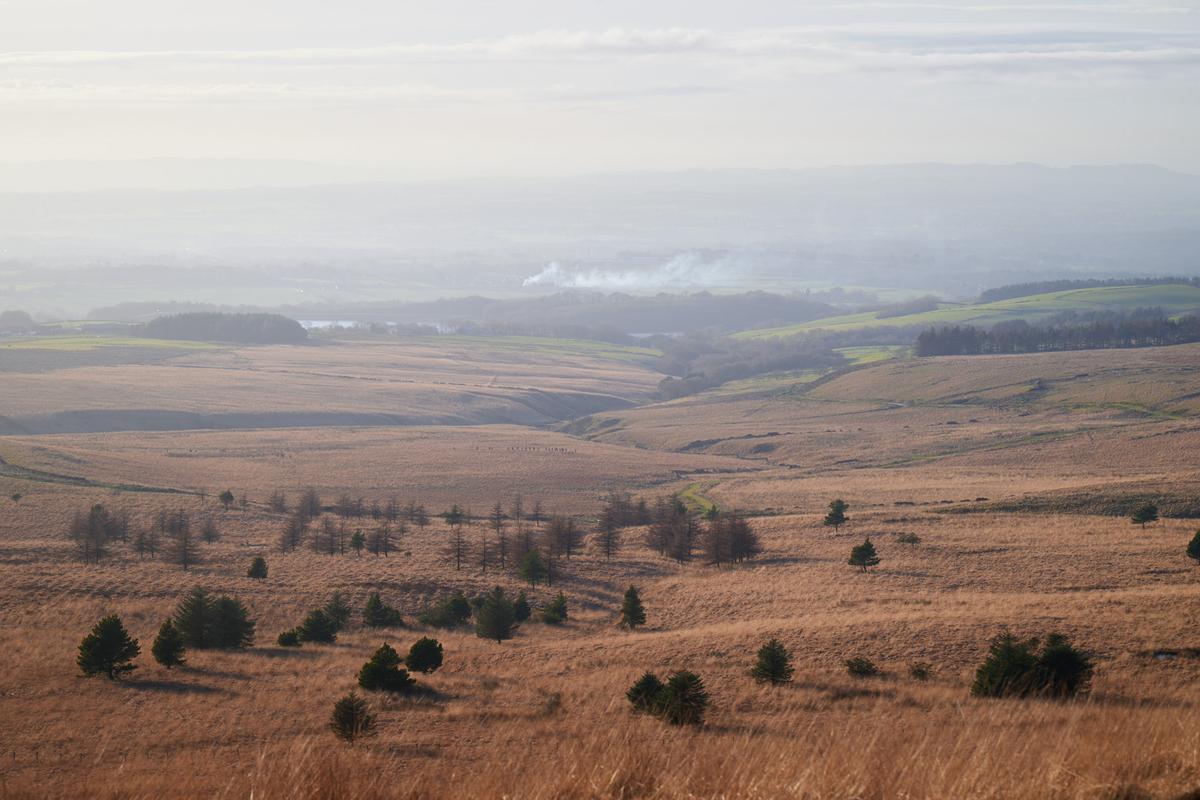
    DSC_1110.jpg

    The Yarrow Valley

    From Spitlers Edge there's a splendid view along the earliest parts of the Yarrow Valley, the source of The Yarrow is actually marked by a plaque near the start of Spitlers Edge. The trees in the middle of the frame are where The Yarrow meets Limestone Brook as it emerges from Lead Mines Clough and both are then captured in Yarrow Reservoir, which can just be seen above the trees a little way to the left.
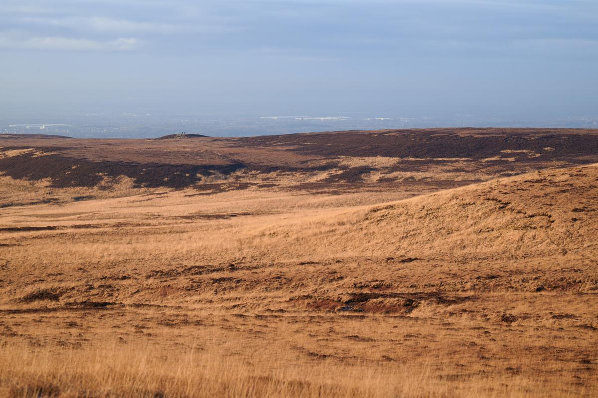
    DSC_1122.jpg

    Round Loaf

    Looking across Anglezarke Moor from the higher reaches of the path you can see the Bronze Age bowl barrow known as Round Loaf as it sits on the lower flanks of Black Hill (seen rising to the right here). If you look carefully you can just make out a group of hikers stood on top of the barrow. Whether there's a cairn there or not this week is debatable.
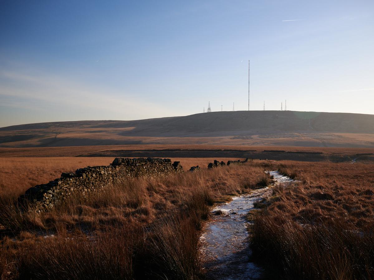
    DSC_1127.jpg

    Redmond's Edge

    Looking further along the path we can see the highest point of Redmond's Edge. The path is still quite the death trap here. In my original plan for this walk, I'd intended to continue along this path to its end at the foot of Great Hill and then cross the moor to Round Loaf before looping back via Limestone Brook, but there was no way I'd be able to complete that in daylight given the time I'd set out at, so instead, I followed this path to its highest point before branching off to the left and following the vague path that leads down Standing Stones Hill.
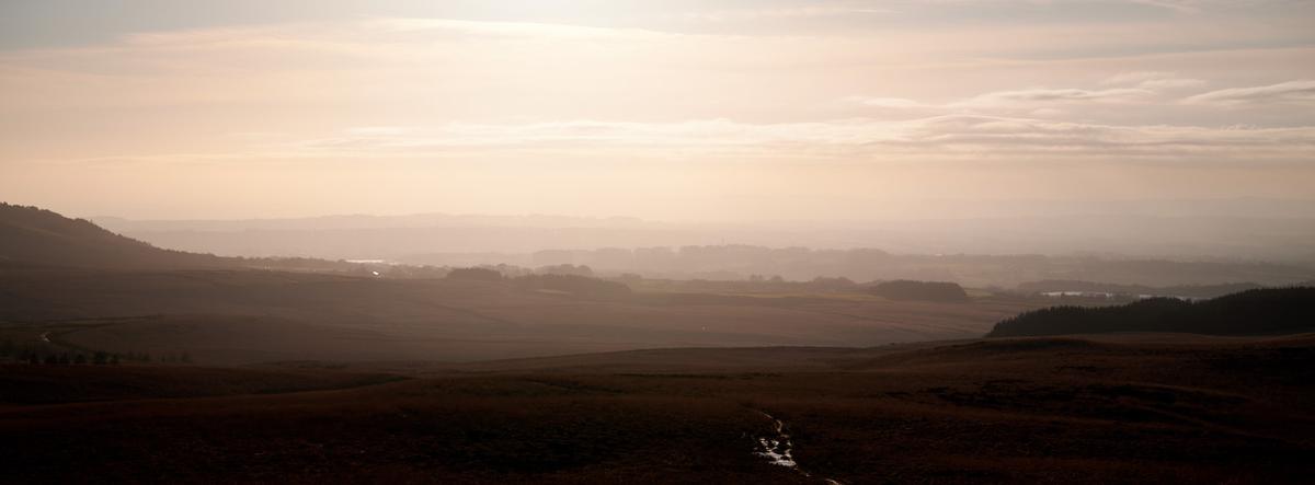
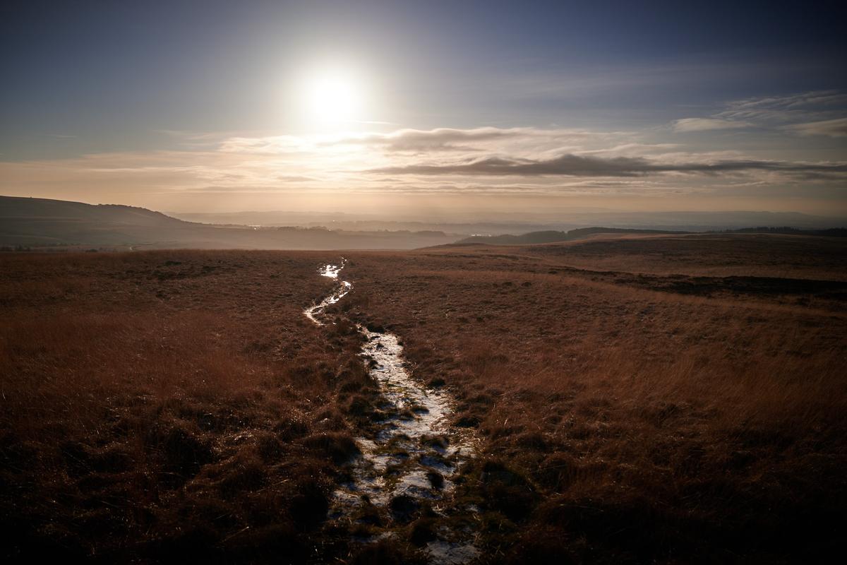
    DSC_1140.jpg

    Misty Moors

    This is looking directly into the sun as I made my way down Standing Stones Hill. Fortunately, for once, I'd remembered to bring sunglasses, otherwise this would have been very uncomfortable. I like the way the backlighting illuminates the mist in the valley.

    DSC_1173.jpg

    Spitlers Edge

    This is the view from the path down Standing Stones Hill, looking to my left in the direction of the hill Spitlers Edge crosses. You can just the see the path of Spitlers Edge on the far left of the picture.

    DSC_1180.jpg

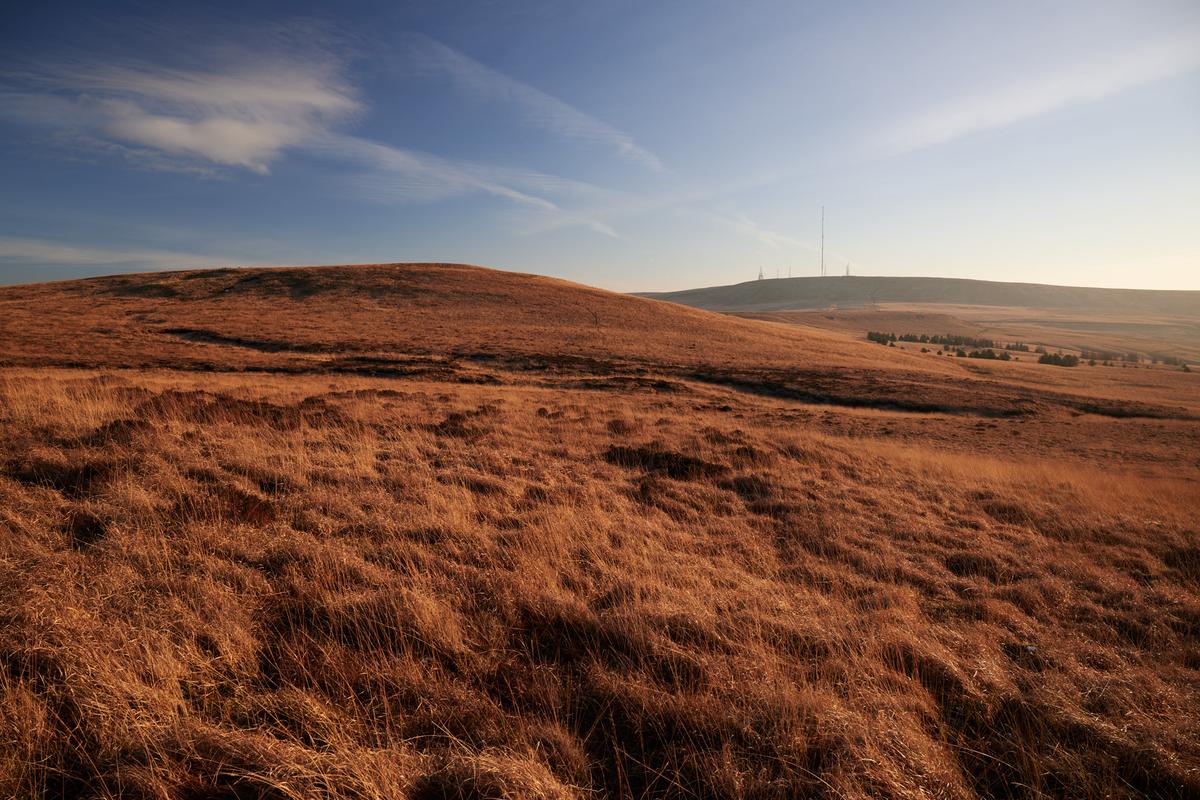
    You Call This A Path?

    The path down Standing Stones Hill was also very icy. The sun is getting quite low by this point and I was keen to get off this part of the moors before it had set.
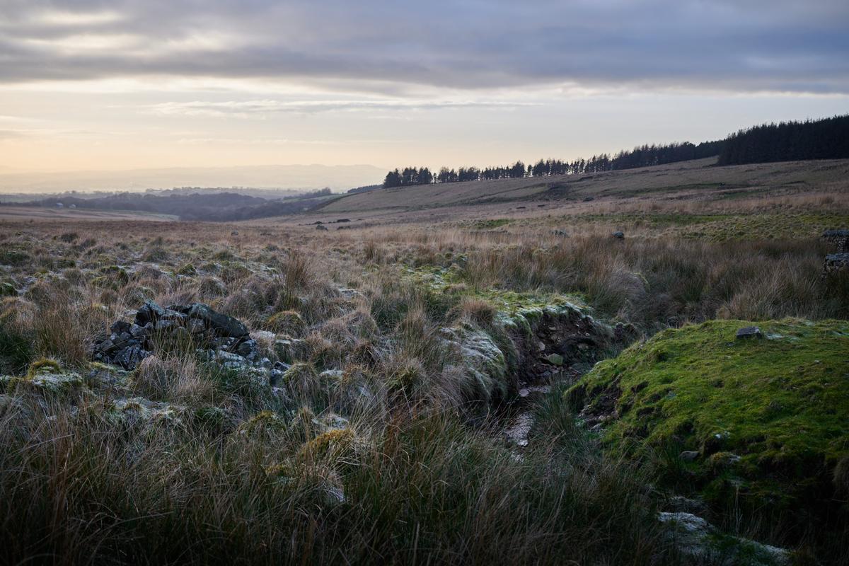
    DSC_1189.jpg

    Icy Yarrow

    The river Yarrow winds its way around the southern boundary of Chorley before joining the Ribble and exiting to the sea. By the time it reaches Chorley it's quite a substantial river, so it's always surprising to see this humble brook it begins as.
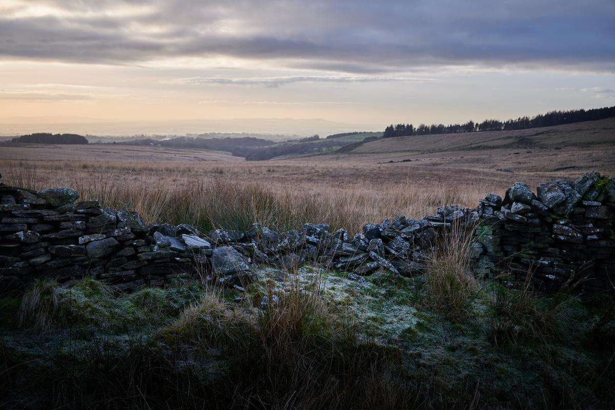
    DSC_1203.jpg

    Fallen Wall

    This is one of the field boundaries near the Hempshaw's ruins. Like many of the walls on the higher moors it's slowly crumbling due to lack of maintenance.

    DSC_1207.jpg

    The Final Climb

    Having passed by the Hempshaw's ruins, I was faced with this steep climb back up to the foot of Spitlers Edge. At this point I was rather glad I hadn't followed the longer route I was initially considering, not to mention questioning my sanity for even considering it.

    DSC_1221.jpg

    DSC_1180.jpg

    JPG, 763.0 KB, uploaded by SteveMonks on Jan. 24, 2026.

    DSC_1236.jpg

    JPG, 335.3 KB, uploaded by SteveMonks on Jan. 24, 2026.

    DSC_1085.jpg

    JPG, 457.1 KB, uploaded by SteveMonks on Jan. 24, 2026.

    DSC_1140.jpg

    JPG, 555.5 KB, uploaded by SteveMonks on Jan. 24, 2026.

    DSC_1203.jpg

    JPG, 569.0 KB, uploaded by SteveMonks on Jan. 24, 2026.

    DSC_1110.jpg

    JPG, 537.6 KB, uploaded by SteveMonks on Jan. 24, 2026.

    DSC_1122.jpg

    JPG, 420.9 KB, uploaded by SteveMonks on Jan. 24, 2026.

    DSC_1207.jpg

    JPG, 517.5 KB, uploaded by SteveMonks on Jan. 24, 2026.

    DSC_1127.jpg

    JPG, 550.9 KB, uploaded by SteveMonks on Jan. 24, 2026.

    DSC_1189.jpg

    JPG, 351.1 KB, uploaded by SteveMonks on Jan. 24, 2026.

    DSC_1221.jpg

    JPG, 704.8 KB, uploaded by SteveMonks on Jan. 24, 2026.

    DSC_1173.jpg

    JPG, 102.6 KB, uploaded by SteveMonks on Jan. 24, 2026.

  • Members 476 posts
    Jan. 24, 2026, 1:39 p.m.

    I like these snowy tree studies...

    ...but this one is my pick from this set...

  • Members 2127 posts
    Jan. 24, 2026, 1:44 p.m.

    I like when you see less and less as you move up. Excellent.

  • Members 1284 posts
    Jan. 24, 2026, 5:18 p.m.

    A Day at the Seaside

    Weather was forecast to be sunny today, so headed out west for a little exploration along the north side of Morecambe Bay towards Barrow-in-Furness.
    Yes, it was mostly sunny, but a bitterly cold east wind - glad I'm not on the North Sea coast!

    Tide still a long way out at mid-morning.

    P1246039.jpg

    P1246042.jpg

    Morecambe Bay is famous for its cockles, and infamous for its tides, which sweep in alarmingly fast across the sandbanks.

    P1246052.jpg

    P1246061-HDR.jpg

    P1246082.jpg

    P1246084.jpg

    This curious tower is Rampside Leading Light, the only remaining one of 13 beacons built in the 19th century to guide ships into the docks at Barrow.

    P1246085-HDR.jpg

    By early afternoon it was high tide. The end of the road is at the lifeboat station on Roa Island, from where there is a summer ferry across to Piel Island with its castle and famous pub.
    visitbarrow.org.uk/piel-island/

    P1246105.jpg

    P1246061-HDR.jpg

    JPG, 3.0 MB, uploaded by Woodsider79 on Jan. 24, 2026.

    P1246082.jpg

    JPG, 3.7 MB, uploaded by Woodsider79 on Jan. 24, 2026.

    P1246084.jpg

    JPG, 2.8 MB, uploaded by Woodsider79 on Jan. 24, 2026.

    P1246052.jpg

    JPG, 2.0 MB, uploaded by Woodsider79 on Jan. 24, 2026.

    P1246042.jpg

    JPG, 1.8 MB, uploaded by Woodsider79 on Jan. 24, 2026.

    P1246105.jpg

    JPG, 3.5 MB, uploaded by Woodsider79 on Jan. 24, 2026.

    P1246085-HDR.jpg

    JPG, 2.2 MB, uploaded by Woodsider79 on Jan. 24, 2026.

    P1246039.jpg

    JPG, 3.0 MB, uploaded by Woodsider79 on Jan. 24, 2026.

  • Members 1284 posts
    Jan. 24, 2026, 5:20 p.m.

    I find this one rather disquieting. The scattered windblown leaves add to the feeling.